Log in
All resources
Create a design
14,157 Free Artworks of Bibliotheque Nationale
bibliothèque nationale de france
a map of the british empire in america with the french and spanish settlements adjacent thereto
dutch golden age painting
prints by rembrandt in the bibliothèque nationale de france
rembrandt
guillaume sanson
america, quarta pars orbis (quam plerunque novum orbem appellitand) primo detecta est anno 1492... - c. visscher, excudit - btv1b7200220t
maps of the islands of greece by marco boschini (1658)
marco boschini
spain in the 1640s
prints by rembrandt in the bibliothèque nationale de france
dutch golden age painting
prints by rembrandt in the bibliothèque nationale de france
dutch golden age painting
prints by rembrandt in the bibliothèque nationale de france
dutch golden age painting
prints after nicolas poussin in the bibliothèque nationale de france
classicism
prints by rembrandt in the bibliothèque nationale de france
dutch golden age painting
prints by rembrandt in the bibliothèque nationale de france
dutch golden age painting
prints by rembrandt in the bibliothèque nationale de france
dutch golden age painting
drawings by édouard manet in the bibliothèque nationale de france
impressionism
prints by rembrandt in the bibliothèque nationale de france
dutch golden age painting
strasbourg in the 1600s
émile schweitzer
collections of the bibliothèque nationale de france
drypoint prints by émile malo-renault
siege of strasbourg
émile schweitzer
les nabis,impressionism,symbolism,post-impressionism,art nouveau
1902 cartoons
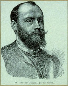
joseph wencker
self-portraits
constance of castile, duchess of lancaster
1386
mathilde bonaparte
portraits by nadar
bibliotheque nationale ms fr. 68
fulk of jerusalem in miniature
bibliotheque nationale ms fr. 68
battle of hattin
christian romstet
heinrich schütz
statuts de l'ordre de saint-michel - bnf fr19819
renaissance
mathilde bonaparte
portraits by nadar
bibliotheque nationale ms fr. 68
ioannes ii komnenos in art
maps of algiers by braun & hogenberg
algiers in the 17th century
maps of bonn by braun & hogenberg
bibliothèque nationale de france
chorographia britanniae (1741-1742)
bibliothèque nationale de france
bibliothèque nationale de france
guillaume sanson
maps of the islands of greece by marco boschini (1658)
old maps of samos
maps of bamberg by braun & hogenberg
bibliothèque nationale de france
america, quarta pars orbis (quam plerunque novum orbem appellitand) primo detecta est anno 1492... - c. visscher, excudit - btv1b7200220t
bibliothèque nationale de france
arnold van langren map of southwest africa
bibliothèque nationale de france
bibliothèque nationale de france
guillaume sanson
maps by willem and johannes blaeu
maps of the duchy of montferrat
chorographia britanniae (1741-1742)
england in the 1740s
regnorum hispaniae nova descriptio (blaeu)
spain in the 1640s
a map of the british empire in america with the french and spanish settlements adjacent thereto
bibliothèque nationale de france
maps of ancient italy by philipp clüver
old maps of marche
bibliothèque nationale de france
maps by thomas kitchin
maps of the islands of greece by marco boschini (1658)
old maps of kalogeros islets
a map of the british empire in america with the french and spanish settlements adjacent thereto
bibliothèque nationale de france
a map of the british empire in america with the french and spanish settlements adjacent thereto
bibliothèque nationale de france
regnorum hispaniae nova descriptio (blaeu)
spain in the 1640s
map of the strait of kerch by guillaume sanson
bibliothèque nationale de france
a map of the british empire in america with the french and spanish settlements adjacent thereto
bibliothèque nationale de france
maps of alhama de granada by braun & hogenberg
bibliothèque nationale de france
a map of the british empire in america with the french and spanish settlements adjacent thereto
bibliothèque nationale de france
a map of the british empire in america with the french and spanish settlements adjacent thereto
bibliothèque nationale de france
a map of the british empire in america with the french and spanish settlements adjacent thereto
bibliothèque nationale de france
18th-century maps of england and wales
chorographia britanniae (1741-1742)
a map of the british empire in america with the french and spanish settlements adjacent thereto
bibliothèque nationale de france
maps of münstermaifeld by braun & hogenberg
maps of cochem by braun & hogenberg
regnorum hispaniae nova descriptio (blaeu)
spain in the 1640s
maps of the islands of greece by marco boschini (1658)
old maps of kea (cyclades)
a map of the british empire in america with the french and spanish settlements adjacent thereto
bibliothèque nationale de france
maps of the islands of greece by marco boschini (1658)
old maps of psarà
maps of heide by braun & hogenberg
bibliothèque nationale de france
america, quarta pars orbis (quam plerunque novum orbem appellitand) primo detecta est anno 1492... - c. visscher, excudit - btv1b7200220t
bibliothèque nationale de france
a map of the british empire in america with the french and spanish settlements adjacent thereto
bibliothèque nationale de france
a map of the british empire in america with the french and spanish settlements adjacent thereto
bibliothèque nationale de france
america, quarta pars orbis (quam plerunque novum orbem appellitand) primo detecta est anno 1492... - c. visscher, excudit - btv1b7200220t
bibliothèque nationale de france
bibliothèque nationale de france
guillaume sanson
maps of île-de-france by françois de la guillotière
context files from gallica
maps of schwäbisch hall by braun & hogenberg
bibliothèque nationale de france
serenissimae reipublicae genuensis ducatus et dominii nova descriptio - gio. bat.ta vrints - btv1b53042587g
context files from gallica
graecia foederata sub agamemnone ob helenae raptum in troiam conjurans - guillaume sanson... ; lud. cordier sculpsit - btv1b53214052d
guillaume sanson
jodocus hondius ii, nova totius terrarum orbis geographica ac hydrographica tabula, 1636
bibliothèque nationale de france
situs terrae promissionis by christian van adrichom
bibliothèque nationale de france
bibliothèque nationale de france
maps by thomas kitchin
maps of barbary coast by mercator-hondius
bibliothèque nationale de france
bibliothèque nationale de france
carolus allard
maps of liège by baptista van doetecum
bibliothèque nationale de france
map of the bosphorus strait by guillaume sanson (1665)
bibliothèque nationale de france
territorium argentoratense (1652 map)
context files from gallica
america, quarta pars orbis (quam plerunque novum orbem appellitand) primo detecta est anno 1492... - c. visscher, excudit - btv1b7200220t
bibliothèque nationale de france
maps of dordrecht by braun & hogenberg
bibliothèque nationale de france
america, quarta pars orbis (quam plerunque novum orbem appellitand) primo detecta est anno 1492... - c. visscher, excudit - btv1b7200220t
bibliothèque nationale de france
maps by emanuel bowen
1740 maps
bibliothèque nationale de france
guillaume sanson
maps by willem and johannes blaeu
17th-century maps of dombes
situs terrae promissionis by christian van adrichom
context files from gallica
maps of halberstadt by braun & hogenberg
maps of quedlinburg by braun & hogenberg
regnorum hispaniae nova descriptio (blaeu)
spain in the 1640s
maps of mexico city by braun & hogenberg
maps of cusco by braun & hogenberg
a map of the british empire in america with the french and spanish settlements adjacent thereto
bibliothèque nationale de france
description of the nobility of hainaut by braun & hogenberg
bibliothèque nationale de france
a map of the british empire in america with the french and spanish settlements adjacent thereto
bibliothèque nationale de france
maps of the principality of erbach
maps by pieter van der keere
maps of nové zámky by braun & hogenberg
maps of visegrád by braun & hogenberg
bibliothèque nationale de france
guillaume sanson
1750s maps of the caribbean
maps by thomas kitchin
maps of the islands of greece by marco boschini (1658)
old maps of rhodes
america, quarta pars orbis (quam plerunque novum orbem appellitand) primo detecta est anno 1492... - c. visscher, excudit - btv1b7200220t
bibliothèque nationale de france
maps of gmunden by braun & hogenberg
bibliothèque nationale de france
maps of innsbruck by braun & hogenberg
alexandre colyn
bibliothèque nationale de france
maps by thomas kitchin
maps of moers by johannes mercator
bibliothèque nationale de france
maps of barbary coast by mercator-hondius
bibliothèque nationale de france
maps of aalst by braun & hogenberg
peter von brachel
bibliothèque nationale de france
maps of limousin by jean fayen
maps of polná by braun & hogenberg
bibliothèque nationale de france
maps by willem and johannes blaeu
1630s maps of asia
8401 - 8500 of 14,157
Next page
/ 142